Gas (Eure-et-Loir)
Gas ist eine französische Gemeinde mit 752 Einwohnern (Stand: 1. Januar 2021) im Département Eure-et-Loir in der Region Centre-Val de Loire. Sie gehört zum Arrondissement Chartres und zum Kanton Épernon. Die Einwohner werden Gassiens genannt.
| Gas | ||
|---|---|---|
.svg.png.webp)
|
| |
| Staat | Frankreich | |
| Region | Centre-Val de Loire | |
| Département (Nr.) | Eure-et-Loir (28) | |
| Arrondissement | Chartres | |
| Kanton | Épernon | |
| Gemeindeverband | Portes Euréliennes d’Île-de-France | |
| Koordinaten | 48° 34′ N, 1° 40′ O | |
| Höhe | 107–161 m | |
| Fläche | 11,97 km² | |
| Einwohner | 752 (1. Januar 2021) | |
| Bevölkerungsdichte | 63 Einw./km² | |
| Postleitzahl | 28320 | |
| INSEE-Code | 28172 | |
| Website | http://www.gas-mairie.info/ | |
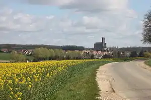 Blick auf Gas (2016) | ||

Geographie
Gas liegt etwa 18 Kilometer nordöstlich von Chartres. Umgeben wird Gas von den Nachbargemeinden Hanches im Nordwesten und Norden, Épernon im Nordosten, Écrosnes im Osten, Gallardon im Südosten und Süden, Bailleau-Armenonville im Süden, Yermenonville im Südwesten sowie Houx im Nordwesten.
Bevölkerungsentwicklung
| Jahr | 1962 | 1968 | 1975 | 1982 | 1990 | 1999 | 2006 | 2020 |
| Einwohner | 267 | 255 | 305 | 587 | 623 | 634 | 712 | 774 |
| Quellen: Cassini und INSEE | ||||||||
Weblinks
Commons: Gas – Sammlung von Bildern
This article is issued from Wikipedia. The text is licensed under Creative Commons - Attribution - Sharealike. Additional terms may apply for the media files.